Street (Type 11) Tab
A Type 11 record contains Street Data.
The Street tab is divided into a number of sections as described below.
Street
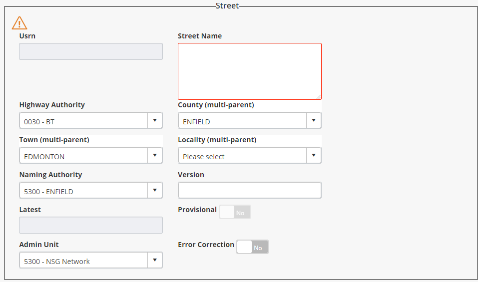
This section contains the following attributes:
- Usrn: The USRN of the Street may be manually entered. If it is left blank a USRN value will be automatically created by the system when the Street is saved. The USRN will be generated based upon the ‘Naming Authority’ and next available number for that Authority. Once saved, this value cannot be amended.
- Street Name: The name of the street.
- Highway Authority: This is the Highway Authority Code for the Street. Valid Highway Authorities are defined for an Organisation using NSG0070 – Maintain Highway Authorities. The Highway Authority Name is displayed in the adjacent field.
- County (multi-parent): This is the name of the County within which the Street is located. The list of available Counties is determined by the Highway Authority selected previously. The relationship between a Highway Authority and a County is defined using Maintain Highways Authorities – NSG0070.
- Town (multi-parent): This is the name of the Town within which the Street is located. The Town Name is validated against the ‘County’ value to ensure that only Towns within the selected County are selected.
- Locality (multi-parent): This is the name of the locality within which the Street is located. The Locality name is validated against the ‘Town’ value to ensure that only Localities within the selected Town are selected.
- Naming Authority: This is the Naming Authority for the Street. The value entered will be used when validating / generating the USRN.
- Version: This is the Version Number of Street. When creating a new Street the Version Number will default to 1. This can be amended if necessary. If Street Gazetteer Manager is not in Error Correction Mode, any subsequent changes to the Street record will force versioning.
- Latest: The Latest checkbox will indicate whether the version of the current street is the latest version. The value for the attribute that the checkbox is based on is derived on insert of streets, update of streets, versioning, and loading.
- Provisional: If the street is a Provisional Street turn the Provisional flag to Yes. A USRN will not be generated for Provisional Streets.
- Admin Unit: The Admin Unit field is not used within BS7666, but is used as part of the overall security regime. Each Street is assigned an Admin Unit and in general terms a user cannot access a Street unless they have been granted the appropriate privileges to the Admin Unit.
- Error Correction: Occasionally it may be necessary to correct errors, such as a misspelt Street Name, a missing Town or Locality without versioning the Street. Turning on Error Correction Mode allows any Street attribute to be updated without versioning the Street. Set the Error Correction flag to Yes to turn on Error Correction Mode.
Street Dates

This section contains the following attributes:
- Start Date: This is the Start Date, which will default to the current system date. Either enter the required date or press the dropdown list button and select the required date from the calendar.
- Entry Date: This is the record entry date, the date the record was entered into the NSG, which will default to the current system date. Either enter the required date or press the dropdown list button and select the required date from the calendar.
- Closure: This is the date on which a Street is either closed or versioned. Closed Streets may be viewed by setting the Effective Date to a date that precedes the closure date.
- Last Updated: The date any attribute on the street was last updated.
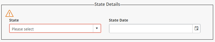
State Details
Street Coordinates

This section contains the following attributes:
- Start X: For a Level 3 Street DO NOT enter the Start or End X/Y Coordinates. These will be automatically calculated when the Streets constituent ESU are added.
- Start Y: For a Level 3 Street DO NOT enter the Start or End X/Y Coordinates. These will be automatically calculated when the Streets constituent ESU are added.
- End X: For a Level 3 Street DO NOT enter the Start or End X/Y Coordinates. These will be automatically calculated when the Streets constituent ESU are added.
- End Y: For a Level 3 Street DO NOT enter the Start or End X/Y Coordinates. These will be automatically calculated when the Streets constituent ESU are added.
- Tolerance: This is the spatial tolerance of the Start and End Coordinates of the Street.
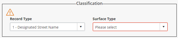
Classification
Alias (English Welsh Users Only)

When signed in as an English/Welsh user the Street tab will also have an Alias section that allows you to enter the Welsh alias for the street.
Map
The dialog also includes an interactive map of the street.